Present
I'm learning to build with AI — starting with geospatial ML and moving into AI-assisted policy tools. Still figuring out the full stack, but care deeply about who it's built for.
- Machine learning pipelines
- AI-assisted data products
- LLM experimentation & integration
I work on the reliability side of critical national infrastructure — keeping things running, automating the boring stuff, and making sure good intentions don't break in production.
- Microservices & distributed systems
- Incident management & SLO design
- Infrastructure as code & CI/CD
Practice-based PhD at UAL examining what communities lose when they lose control of their data — and building the infrastructure to give it back.
Drawing on archival research into pre-digital grassroots governance, I'm developing open-source tooling that encodes community-set rules directly into AI data pipelines — making data sovereignty machine-readable for the first time.
- AI data governance & community sovereignty
- Policy-as-code & cloud infrastructure
- Archival research & co-design
Fruits
More details coming soon.
More details coming soon.
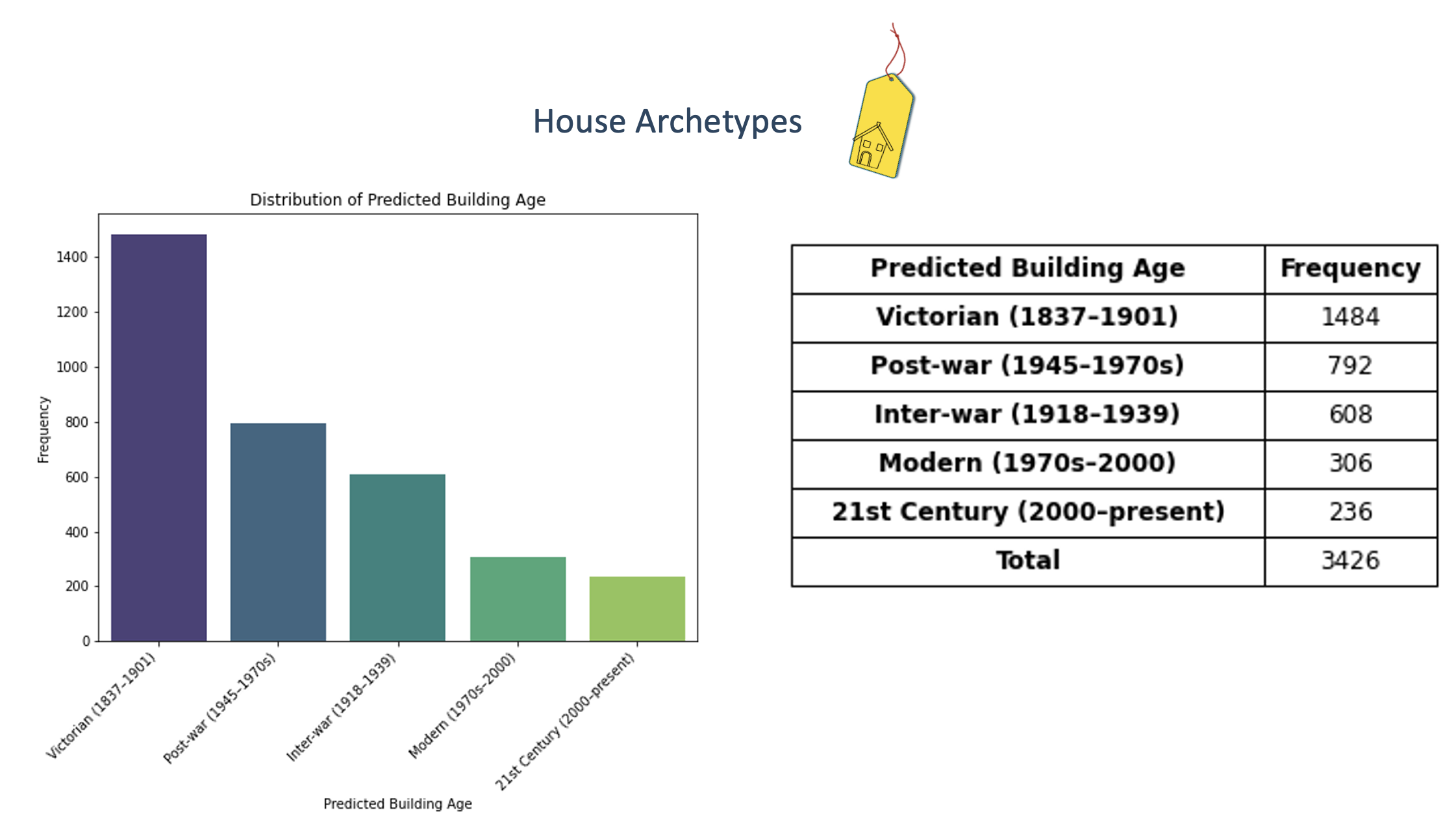
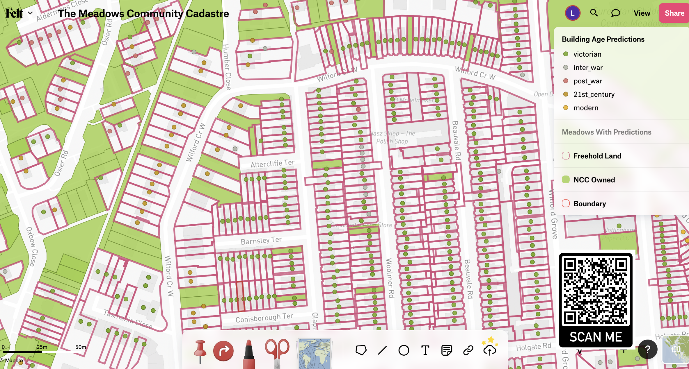
Using open geospatial data and machine learning to help communities understand land ownership and plan carbon emission reductions.
Land ownership in England is an obscure and complex issue — tied to power, money, and influence. In the UK, there's no public list showing who owns what land or property. I used free data and software to predict the ages of buildings, helping a community identify the most appropriate energy efficiency upgrades.

4-Step Methodology
- Define the Cadastre — Set success criteria with a community partner: land ownership type, house archetypes, and a viewable map.
- Identify Open Data & Tools
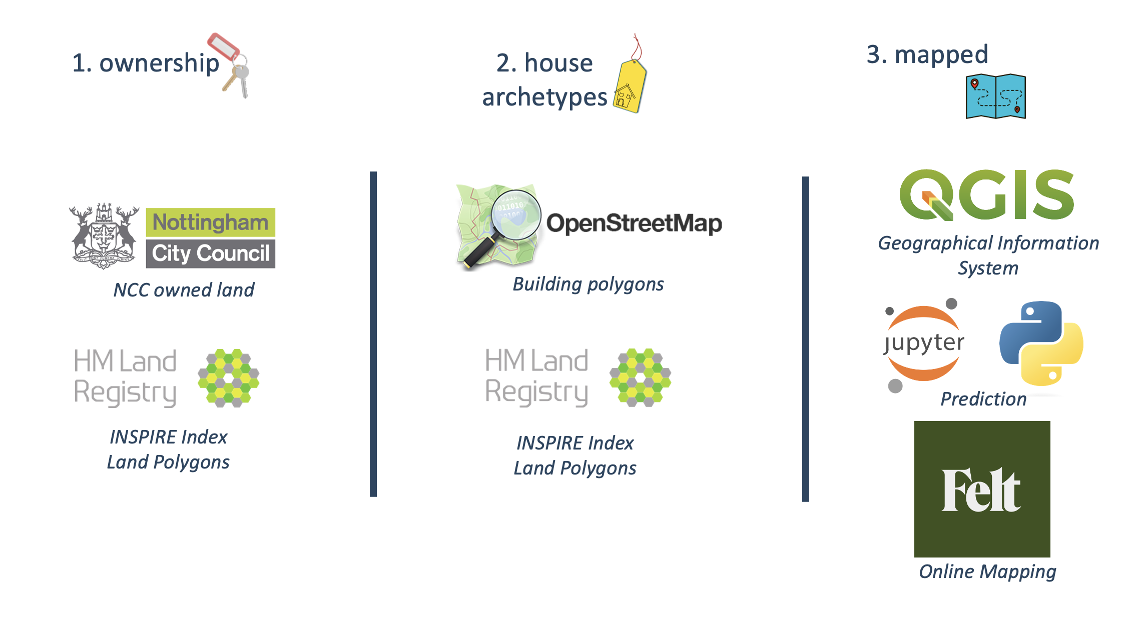
- Machine Learning — Predicted building ages using land area, perimeter, coordinates, and building-to-land ratio.
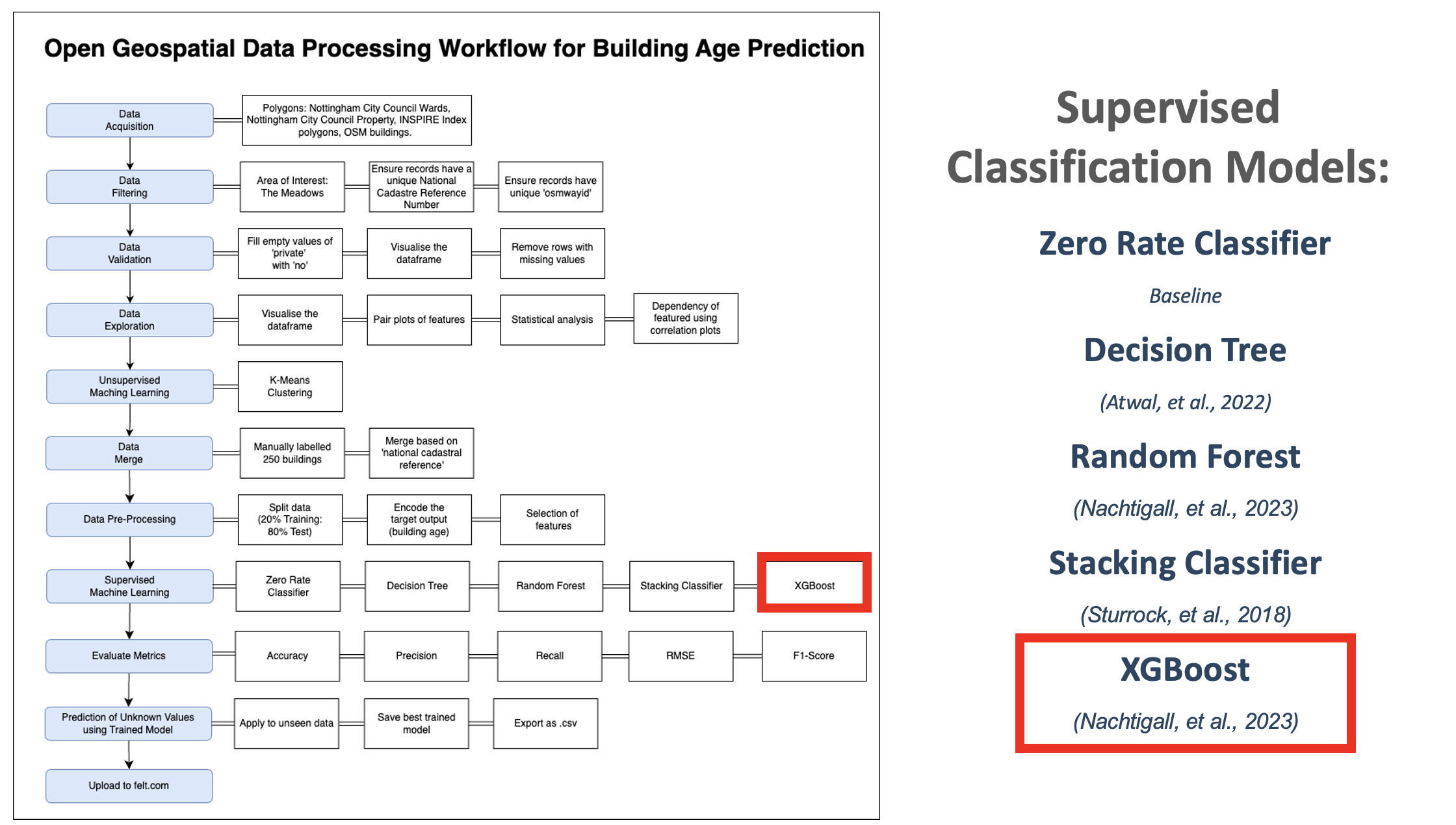
- Proof of Concept — Evaluated supervised and unsupervised algorithms, then uploaded predictions to an interactive map.
Explore the live map →
Visual policy frameworks for government engagement with faith groups in post-Brexit UK.
Following the Brexit referendum and a rise in hate crime statistics, the UK Government formed its Integrated Communities Strategy. I designed a visual to facilitate discussions on government engagement with faith communities.
Using Policy Lab's Styles of Government Intervention, I mapped actions across sectors — resulting in seven prioritised interventions, including WhatsApp Community Notice Boards.
Leading organisational change to embed equality duties in local government planning practice.
As an Urban Planner, I led a team developing the organisation's understanding of its equalities duties under The Equality Act 2010. I gathered anonymised case studies, then designed and led interactive workshops — creating a safe space for learning and collaborative problem-solving.
An open Actions Table was co-created as a living document for staff to contribute to before, during, and after sessions.
Past
More details coming soon.
More details coming soon.